Motus Wildlife Tracking System Background: What is Motus?
Part I in a five-part series
Motus is a relatively recent program in Belize. But what is Motus? What is it used for? Who uses Motus, and how is it beneficial? These are possibly just a few questions which may come to anyone’s mind upon hearing the word for the first time. There is a lot to learn about Motus – how highly beneficial it is to the scientific community, to private landowners and managers, to stewards and caretakers of protected areas, to forest and nature reserve managers, to educators and students, and even to the local populace. It is a tool which provides meaningful data on current and future migratory ecological wildlife studies. Such data can be utilized by decision makers, especially in government circles, to help prioritize areas for wildlife protection. In general, Motus (the Latin word for movement), is an international collaborative network of researchers that use automated radio telemetry to simultaneously track and study the migratory movements of birds, bats, and large insects at local, regional, and hemispheric scales. Therefore, this article aims to look at Motus in a bit more detail.
Motus was developed by Bird Studies Canada in 2014. Funding and support was provided by Canadian Foundation for Innovation grant, in partnership with Acadia University, (Nova Scotia), Western University (Ontario), the University of Guelph (Ontario), and other collaborating researchers and organizations.
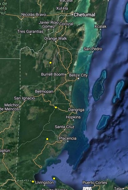
In March 2023, BFREE became a part of this international network by installing two antennas to the 145′ radio tower at BFREE adjacent to the dining room (Lat. 16.5551o Lon. 88.7065o). Prior to the BFREE installation, only one Motus Tower existed in Belize and this tower was installed at Toucan Ridge Ecology and Education Society (TREES) on May 2022 in Central Belize (Lat. 17.0526o Lon. 88.5654o). Following the BFREE installation, another Motus Tower was installed at the Lamanai Field Research Station in Northern Belize (Lat. 17.7521o Lon. 88.6538o). The other two closest Motus Towers to Belize are in neighboring Guatemala. The yellow dots indicate where Motus towers have been installed and activated in Belize and Guatemala. (Figs. 1 & 2).
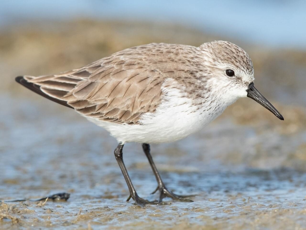
Motus continues to expand globally. For example, in the USA along the Pacific Coast flyways, Motus towers are being installed along the coasts of Oregon and Washington. The towers in these areas are collecting data on shore-bird movements such as Western Sandpiper, Sanderling, Semipalmated Plover, and Dunlin. Interestingly, all four species except for the Dunlin, are regular winter visitors along Belize’s shoreline and Cayes, while the Dunlin is considered a “transient” species but also uses the coastline and Cayes as stopover sites while migrating to countries further south. Such data continues to provide valuable information on migratory pathways, stopover sites, breeding, and wintering habitats of these birds. Researchers, scientists, and biologists working in this region are also working with partners in Mexico on Birds of Conservation Concern such as the Pacific Red Knot, one of the longest distance flyers of any shorebird. Interestingly, Belize has very few records of this species along the northern coastline.
Data collected from the Motus Towers detects the different estuaries where the Pacific Red Knot migrates, how they’re using estuaries, and how long they stay there. In 2022, several Motus stations were installed in Puerto Rico in partnership with Birds Caribbean. The Caribbean Motus Collaboration (CMC) was formed to expand the Motus network in the Caribbean as part of the Landbird Monitoring Project. Recently, through the Neotropical Migratory Bird Conservation Act (NMBCA) grant program, the international collaboration expanded and funded additional Motus station installations and research across the Americas, including the first Motus bird monitoring network in Mexico.
During its first three years, Motus expanded to include more than 120 independent research projects, and comprised over 325 active receiver stations across 11 countries and 3 continents. This rich and comprehensive data set included detections of individuals during all phases of the annual cycle (breeding, migration, and non-breeding).
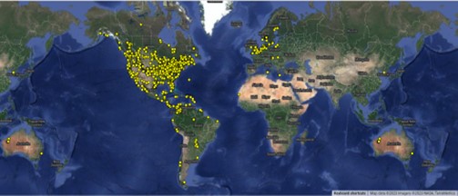
According to a recent article written by Rosalie Wetzel and published in May 2023, Motus has grown to include more than 1,200 stations across 31 countries. Again, the yellow dots indicate Motus stations throughout the world. Motus is indeed the largest international collaborative research network that brings together organizations and individuals to facilitate research and education on the ecology and conservation of flying migratory species.
Most of the information and graphics used in this article were obtained from the following sources:
- Birds Canada. 2019. Motus Wildlife Tracking System. Port Rowan, Ontario. Available: http://www.motus.org. Accessed: October 2, 2023.
- Taylor, et.al. 2017. The Motus Wildlife Tracking System: a collaborative research network to enhance the understanding of wildlife movement. Accessed: October 4, 2023.
- Rosalie Wetzel. May 31, 2023. U.S. Fish and Wildlife Service. Motus Stations: Tracking Migrations from Coast to Coast. Accessed: October 5, 2023.
- Michael Rogers summary of BFREE Motus Tower. October 2023.
Stay tuned for Series Article Part II: How does Motus work?


Leave a Reply
Want to join the discussion?Feel free to contribute!